This walk was organised and led by me as an irregular CBC Tuesday walk:
Tuesday 29 September – Border Markers near Blackfellows Gap - L/M-R,ptX. A quick insertion to the SE spur of Mt Gingera via Stockyard Spur and the Mt Franklin Fire trail. Hunt border markers from O58 south, through Blackfellows Gap and onto ‘Ginger-Ale’. Guaranteed a long day for dedicated BM hunters. Around 29km + 1400m climb. Maps: Corin Dam 1:25000. Limit of 8. Leader: John Evans – jevans@pcug.org.au, (h) 6288 7235. Transport: ~$20 per car. Further details at http://jevans.pcug.org.au.
4 of us met in Duffy and Quentin kindly drove us. After the cold conditions of Saturday and Sunday, with snow down to 700m on Sunday morning, we were not expecting good news. I should have checked the road closures; at least I had plans B and C loaded in my GPS.
A very early start to take advantage of Civil twilight: 29/09/2009 Rise 0518 Set 1830
I mentioned this walk to my companions on 15 Sep 09. Strangely, one said they would be in NZ, the other in WA. I wonder why?
An option under consideration is to drive to the Mt Ginini car park and start from there. My thesis is that drive to Mt Ginini + walk to Pryors Hut (4.8km, 100m climb) approx= drive to Corin Dam + walk to Pryors Hut (6.8km, 850m climb), in time. Maybe + 30mins via Ginini. This certainly gives a more reasonable gradient for the start. Leave town at 6am.
Walk
The road signs near Uriarra Homestead told us that the Mt Franklin Road was closed at Bulls Head, so as we drove on I pulled out the maps for plan C and loaded my GPS with the relevant waypoints from the SD card. Lovely to be driven safely and surely to Bulls Head by Q.
We identified border markers:
E52, F52, G52, H52, I52, J52, 7 Mile, K52, L52, M52, N52, O52, P52, Q52, R52, S52, 8 Mile, T52, U52, V52, W52, X52, Y52, Z52, A53, B53, C53, 9 Mile, D53, E53, F53, G53, H53, I53, J53, K53, L53, M53, N53, O53, P53, Q53, R53, S53, T53, U53, V53, W53, X53, 11 Mile, Y53, Z53, A54, B54, C54, D54, E54, 12 Mile, F54, G54, H54, I54, J54, K54, L54, M54, N54, O54, P54, 13 Mile, Q54, R54, S54, T54, U54, V54, W54, X54 AND Y54.The photos of them are below and also on the ACT-NSW Border Markers and Lockspits page.
Border markers which could not be identified were:
14 Mile and Z54 (Z54 is located smack in the middle of the road at Aggie Gap). I did not have the location of 10 Mile with me.
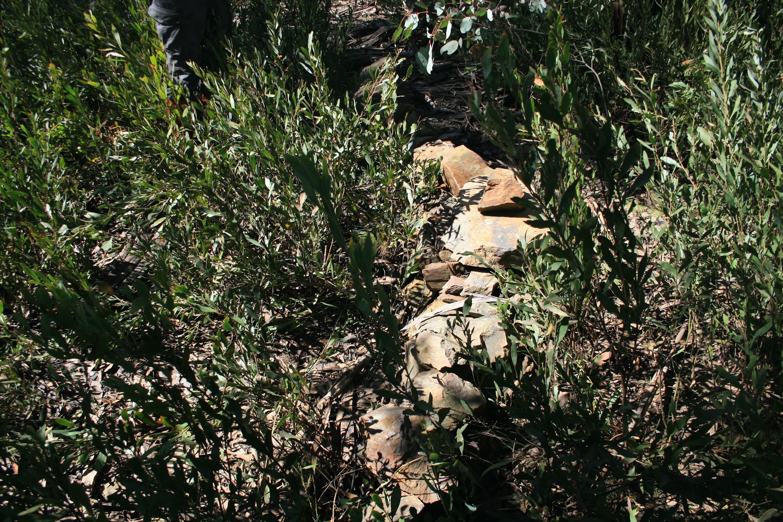
There were a couple of snowmen still standing near the car park, remains of kids activities on the weekend no doubt. I hoped that the snow, no doubt to get full cover as we climbed higher, would not obscure the lockspits. We were immediately drawn to the lovely Lawson Cypress and Tony Franklin plaque. However, business was at hand and the nearest border marker was E52. This one and F52 were a bit snowy, but once up and over the rise and going down the spur to the SW, G52, H52 and I52 were clear. At J52 we crossed the Mt Franklin Road. 7 Mile, K52, L52 and M52 were all to the E of the road, with interesting rock formations between 7 Mile and K52. Crossed the road again to find N52, O52 (within sight of the road and which we adorned with nearby quartz rocks), P52, Q52, R52, S52 and, climbing towards Forest Knob, 8 Mile. At each border marker we did a little clearing, the occasional gardening and, where it was obvious that the lockspit had been disturbed, a modicum of reconstruction.
With mutinous rumblings from party members' stomachs, T52 provided a lovely seat in unburnt open forest at Forest Knob for morning tea number 1 at 8.50am.
From Forest Knob the border swings W down then up to Bushrangers Hill. We passed through border markers U52, V52, W52, X52, Y52, Z52 and A53. Interesting to see the amount of snow in the photos - a bit coming down from Forest Knob (U52, V52), none in the saddle or beginning to climb to Bushrangers Hill (W52, X52), a bit towards the top at 1307m (Y52, Z52, A53). The last border marker was the site of morning tea number 2.
From here, the border took us south back down to cross the Mt Franklin Road where Chalet Road and Moonlight Hollow Road intersect with it. Border markers B53, C53, 9 Mile and D53. Crossing to the E of the Mt Franklin Road, E53 was pretty much at the location where Max and I enjoyed a beer on 15 Mar 06. Funny the things you don't see when you don't have your BM-hunting eyes on.
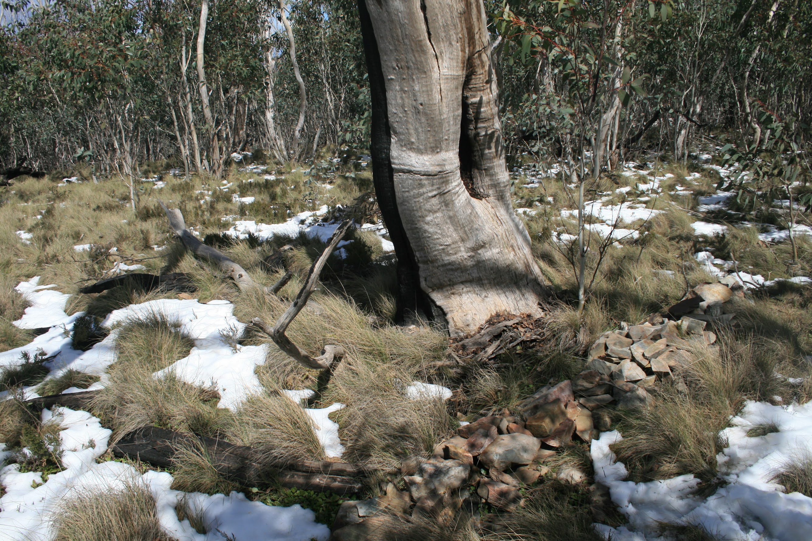
The spur up to Bendoura Hill took us to 1451m. Ever increasing patches of snow at border markers F53, G53, H53, I53 and J53. By the time we reached K53 there was full cover and I was beginning to worry that the snow would hide the markers. But it was glorious - blue sky, no breeze, unburnt forest (see pic 1). We couldn't miss this one.
K53 was at the foot of a large gum which sported an obvious blaze (see pic 1). Not an original, as it was made with a chainsaw. However, the original survey notebook records "212°12' 9.6 Gum" for the survey mark. The border from K53 heads 223°04'44" and 9.6links = 1.93m, so this would be the tree which contained the original CT (with surveyor's arrow above it) survey mark.
On up through L53, M53 and N53. The snow was not deep enough to hide the border markers from us. Lunch was taken at Bendoura Hill, Max kindly scraping the snow off a log for us to sit on.
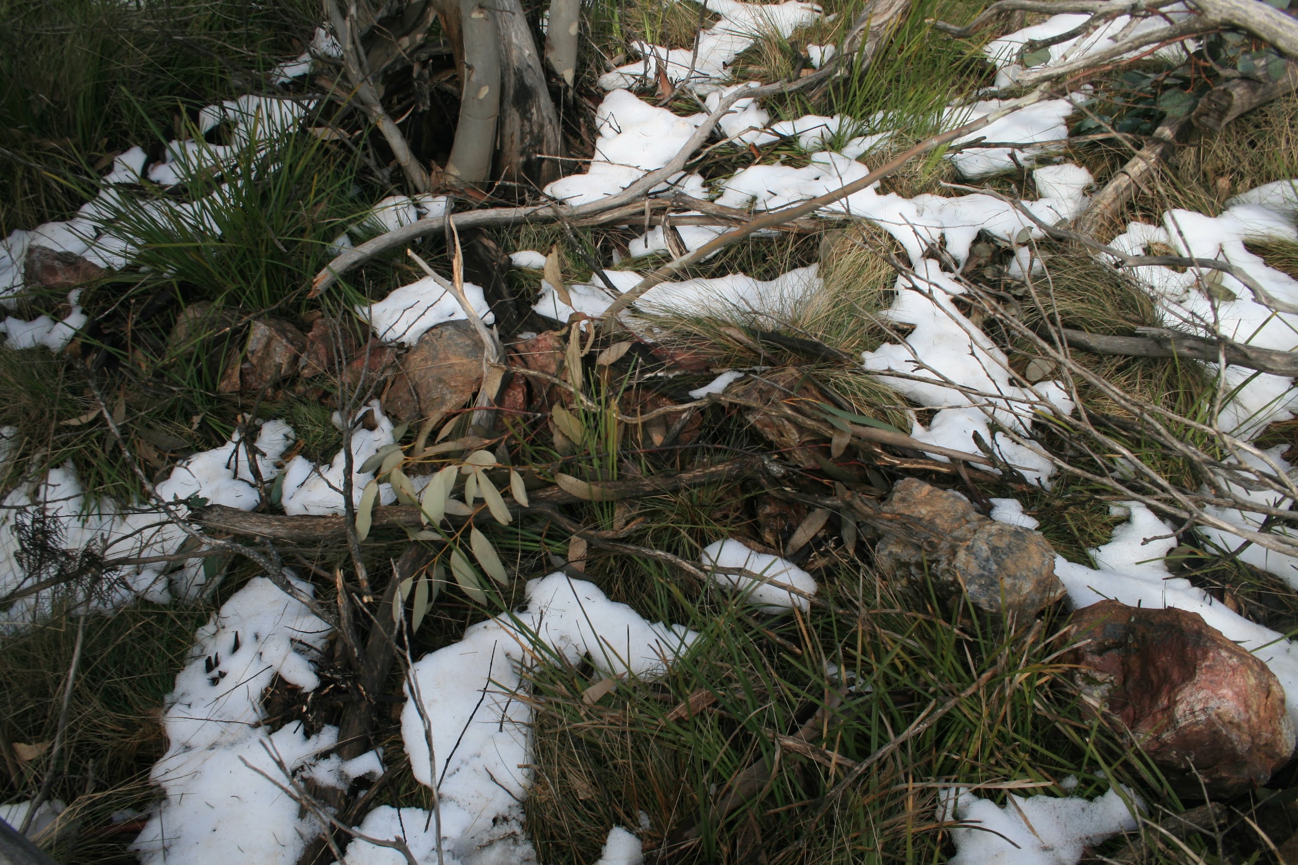
A lovely descent (see pic 2), still plenty of snow on the S spur of the hill as we passed through O53, P53, Q53, R53, S53, T53, U53, V53 and W53. Nearly all gone at X53 and 11 Mile, where the other end of Chalet Road joins the Mt Franklin Road. Y53 could not be closer to the road.
Once again we crossed to the W side of the main road, to find Z53. From here we headed up the gentle slope towards Snow Gum Hill.
A54 had a large, dead gum to the SE with an oval hole in the trunk. The original survey notebook records "149°03' 25.1 to Gum" for the survey mark. The general direction corresponds and 25.1links = 5.05m, so this would most likely be the tree and site of the original survey mark. Exciting to touch history in this small way.
We detoured a few tens of metres to the SE corner of Snow Gum Arboretum, a sad and burnt area. On up the hill through B54, C54 and D54.
Again, E54 had a large, dead gum close by to the E with an oval hole in the trunk. The original survey notebook records "113°31' 4.95 to Gum" for the survey mark. The general direction corresponds and 4.95links = 0.995m, so this would most likely be the tree and site of the original survey mark.
On to 12 Mile.
And, similarly, F54 had a large, dead gum nearby to the NE with an oval hole in the trunk. The original survey notebook records "42°11' 30.1 to Gum" for the survey mark. The general direction corresponds and 30.1links = 6.05m, so this would most likely be the tree and site of the original survey mark.
G54, H54, I54 and J54 took us down the spur to a saddle near SH1415 and the road. Interesting shale rock protrusions between G54 and H54. From J54 the border turned more towards the W on a long, steady, gentle climb towards Mt Aggie. I54, J54, K54, L54, M54, N54 and O54 were duly inspected, our enthusiasm never waning. Interesting rocks again between O54 and P54, marked on the original survey notebook as "Schistose formation".
P54 and 13 Mile are in the same lockspit, P54 being a renewed square white-painted peg under the centre of the lockspit and 13 Mile the original 3" Downpipe filled with concrete in the SW pointing arm of the lockspit.
At Q54 we were greeted by a lethargic black snake draped around the border marker lockspit. It begrudgingly slithered away into the centre - fortunate that we weren't poking around in there with our bare hands, not knowing it was there.
R54 had a large, dead gum nearby to the NE with an oval hole in the trunk. The original survey notebook records "200°39' 13.95 to Gum" for the survey mark. The general direction corresponds and 13.95links = 2.81m, so this would most likely be the tree and site of the original survey mark.
S54 is on a little knoll not far from Mt Aggie, which sports T54. This border marker is in an amazing location, with the different geology of Mt Aggie and the wonderful view down to the Goodradigbee River valley (see pic 3). We spent a few minutes here admiring the view.
By this time it was nearly 3pm, so thoughts turned to the return leg. But I wanted to press on down to Aggie Gap - only then would I be happy. U54, V54, W54, X54 and Y54 took us down towards the Gap. The only disappointment of the whole day then occurred (apart from not having the location for 10 Mile with me and missing that one) - we could not find 14 Mile and Z54 must be smack in the middle of the road at Aggie Gap, as we could not find it either.
The outward leg totalled 12.5km and it was now 3.35pm. I'd not really cared about the return leg along the Mt Franklin Road, but as the sun went west, our enthusiasm (not buoyed by the adrenalin rush of border marker hunting) flagged. Nice views to the W side of the Tidbinbilla Range (see pic 4). In the end the return was 13km and we finished in the moonlight at 6.45pm. Still, didn't have to get a torch out, so I need a later finish that this at some stage.
 |
 |
 |
 |
| E52 | F52 | G52 | H52 |
 |
 |
 |
 |
| I52 | J52 | 7 Mile | K52 |
 |
 |
 |
 |
| L52 | M52 | N52 | O52 |
 |
 |
 |
 |
| P52 | Q52 | R52 | S52 |
 |
 |
 |
 |
| 8 Mile | T52 | U52 | V52 |
 |
 |
 |
 |
| W52 | X52 | Y52 | Z52 |
 |
 |
 |
 |
| A53 | B53 | C53 | 9 Mile |
 |
 |
 |
 |
| D53 | E53 | F53 | G53 |
 |
 |
 |
 |
| H53 | I53 | J53 | K53 |
 |
 |
 |
 |
| L53 | M53 | N53 | O53 |
 |
 |
 |
 |
| P53 | Q53 | R53 | S53 |
 |
 |
 |
 |
| T53 | U53 | V53 | W53 |
 |
 |
 |
 |
| X53 | 11 Mile | Y53 | Z53 |
 |
 |
 |
 |
| A54 | B54 | C54 | D54 |
 |
 |
 |
 |
| E54 | 12 Mile | F54 | G54 |
 |
 |
 |
 |
| H54 | I54 | J54 | K54 |
 |
 |
 |
 |
| L54 | M54 | N54 | O54 |
 |
|
 |
 |
| P54 | 13 Mile | Q54 | R54 |
 |
 |
 |
 |
| S54 | T54 | U54 | V54 |
 |
 |
 |
|
| W54 | X54 | Y54 |
A very successful day, thank you Max, Quentin and Peter. 13.5 hours (my) door to door and an orgy of 79 border markers.
Distance: 25.4km Climb: 950m. Time: 6.55am - 6.45pm (close enough to 12 hrs), with 45mins of stops.
Grading: L/E-M,X; H(14)
KMZ file for Google Earth/Maps: Border Markers between Bulls Head and Aggie Gap


